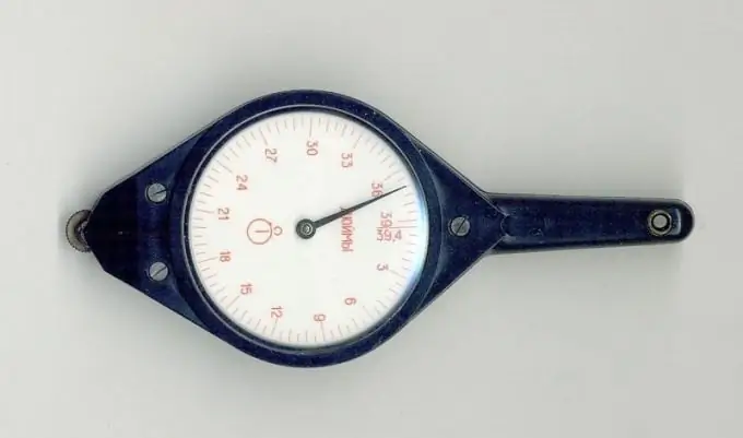
The terrain on the map is always shown in a reduced view. The reduction factor is called scale. By measuring the length of the line on the map, you can then calculate the actual distance between the two objects on the ground.

Instructions
Step 1
If you need to know the distance between two points in a straight line, measure the corresponding segment on the map with a ruler. Preferably, it is made of as thin sheet material as possible. In case the surface on which the card is spread is not flat, a tailor's meter will help. And in the absence of a thin ruler, and if it is not a pity to pierce the card, it is convenient to use a compass for measuring, preferably with two needles. Then you can transfer it to graph paper and measure the length of the segment along it.
Step 2
Roads between two points on the map are rarely straight. A convenient device - a curvimeter - will help to measure the length of the curved line. To use it, first, by rotating the roller, align the arrow with zero. If the curvimeter is electronic, it is not necessary to manually set it to zero - just press the reset button. Holding the roller, press it to the starting point of the cut so that the risk on the body (it is located above the roller) points directly to this point. Then move the roller along the line until the line is aligned with the end point. Read the readings. Please note that some curvimeters have two scales, one of which is graduated in centimeters, and the other in inches.
Step 3
Look for a scale indicator on the map - usually located in the lower right corner. Sometimes this pointer is a piece of calibrated length, next to which is indicated what distance it corresponds to. Measure the length of this line with a ruler. If, for example, it turns out that it has a length of 4 centimeters, and next to it it is indicated that it corresponds to 200 meters, divide the second number by the first, and you will find out that each card has a ready-made phrase instead of a segment, which may look, for example, as follows way: "There are 150 meters in one centimeter." Also, the scale can be specified as a ratio of the following form: 1: 100000. In this case, it can be calculated that a centimeter on the map corresponds to 1000 meters on the ground, since 100000/100 (centimeters in a meter) = 1000 m.
Step 4
The distance measured with a ruler or curvimeter, expressed in centimeters, multiply by the number indicated on the map or the calculated number of meters or kilometers in one centimeter. The result will be the real distance, expressed, respectively, in meters or kilometers.


